In the years 2016, 2017 and 2022, archaeological survey activities at Co Loa relic site, Dong Anh district, Hanoi by geophysical methods took place as part of the cooperation program between Thang Long - Hanoi Heritage Conservation Center, Institute of Archeology and Faculty of Anthropology - University of Wisconsin, Madison (USA).

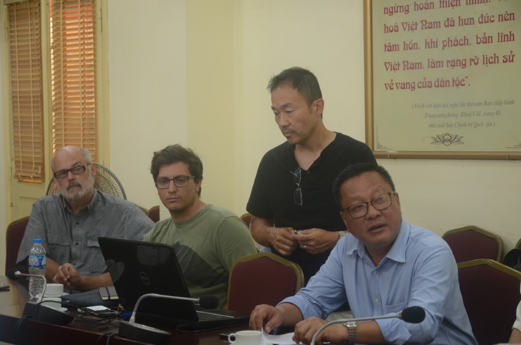
Preliminary report on archaeology survey at Cổ Loa vestige site by international team of archaeologists on July 26, 2022
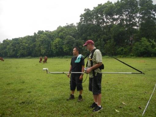
In 2016, 17 areas around the Internal Rampart, the Middle Rampart and the Outer Rampart were selected by the survey team using a magnetometer to find distinct signals underground with a total area of more than 35,000 m2.
In all these 17 sites, at least 220 potential targets have been identified, of which 67 are archaeological targets that can be further investigated, specifically: 8 of which are “high priority” targets (i.e. historical archeological targets), 43 are “moderate to high priority” targets, and 16 are “moderate priority” targets.
Sites 1, 5, 6, 7, 8, 9 (Grid 9-A), 10, 12, 15 and 17 are potential sites for archaeological excavations. Of these, sites 8, 12, 15, 17, and 10 are most likely sites related to factories or early habitation in Co Loa. In grid 9-A, in the Ma Tre area, there are at least 3 targets, one of which belongs to the "medium to high priority" group and is located near the exploratory drill bits that have discovered Co Loa pottery.
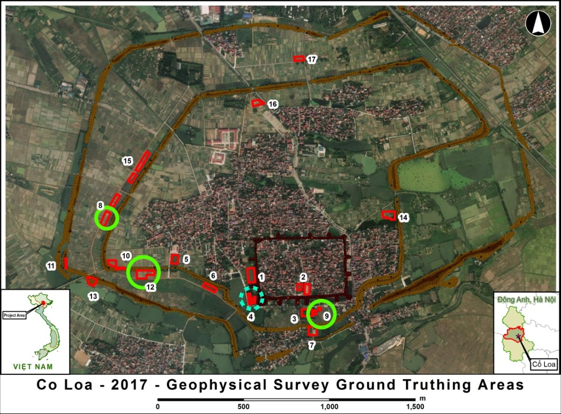 Location of survey sites, survey by geophysical method
In 2017, based on the results of analysis of scan data from 2016, the survey team placed 13 exploration drills (8 cm wide diameter, 1 m - 1.6 m deep) at the following locations: old Cổ Loa high school area (position 3), the garden is located to the right of Thượng Temple - Văn Chỉ area (position 4), Mả Tre (position 9, grid 9-A), Ao Gáo (position No. 12), the field of Gà hamlet is close to Middle Rampart- about 500m north of the Southwest Temple’s gate (position 8). At positions 3 and 4, no artifacts were detected.
On the other hand, at positions 8, 9, 12 discovered burnt charcoal and some pieces of Co Loa tile. At the same time, the survey team dug 02 small trenches (4 x 1m each) at Ao Gao site (position 12, in the crop field in Chua village). This is a highland zone and is located close to the Middle Rampart to the east. One of the inspection trenches discovered evidence of 3 tombs dating from 17 to 18 (Le Trung Hung period). Thus, the survey results are completely consistent with the results of the research method.
3. After obtaining LIDAR data for the Co Loa area in 2017, based on the results of data analysis and comparative documents on maps, archaeologists from the University of Wisconsin - Madison reported the opinion about Co Loa citadel is as follows:
- Firstly, in Middle Rampart, there are also fire embankments located along the southwest corner (equivalent to 90 - 95m apart).
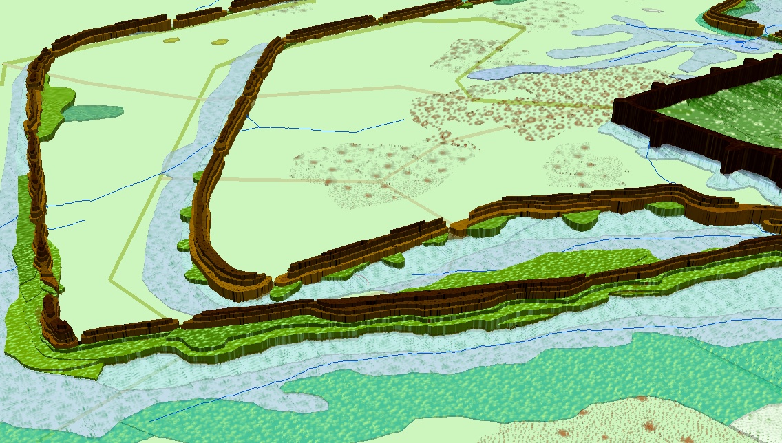 Simulation diagram of the sentries at the southwest corner of Central Citadel
- Second, the area at the southwest corner of the area surrounded by the Citadel appears to be higher and it may have been enclosed by its own wall with sentries.
- Thirdly, in addition to the 3 defined ramparts, there can be other ramparts (istory mentioned that there are 9 ramparts). Specifically, the findings indicate a wall just outside Middle Rampart (proposed to be called Middle Rampart B) and an outer wall of Outer Rampart (proposed to be called Outer Rampart B). Today, it is possible that these "B" walls have transformed into paths.
In 2022, the team continued to survey a number of potential archeological relics in the Middle and Outer Rampart areas, and at the same time verified the hypotheses from previous investigations. In addition, experts have combined with collecting ancient pollen spores samples to analyze and recreate the natural environment of different cultural periods at Co Loa relic.
Thus, this is the first time applying geophysical survey method combined with aerial laser scanning in archaeological research in North Vietnam. The use of geophysical exploration allows archaeologists to scrutinize before conducting actual excavations over a large area and large budget. The main method of archeology geophysics is "the application of terrestrial geophysical methods to find and describe underground archaeological features". In addition, this method also provides both qualitative and quantitative information about aboveground and subsurface artifacts; steps; geometric relationships of those artifacts.
The development of this method marks a potential direction in the use of new research methods with high efficiency in identifying vestiges and studying archaeological sites in the future.
MANAGEMENT DEPARTMENT OF CỔ LOA VESTIGE SITE